

Steyning Downland Scheme: A conundrum - can anyone help?
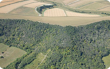
This aerial photo of the Horseshoe Woods, taken last year for the National Park, shows just how much of a problem Ash Dieback has become.In places almost all of the tree canopy is now dead, brittle and highly prone to sudden collapse.
Until we can clear these trees, this is a reminder to please give the woods a wide birth in windy weather - thank you!
. . . and here’s a rather different ‘aerial’ view. This time it’s a map of the Steyning Downland, hand-drawn by a Mr William Figg in the 1820s. Spring Head Shaw can clearly be seen in the centre, just to the right of a ‘U’ shaped piece of woodland, around what is now The Targets.
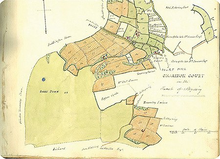
One interesting thing is that all of the Rifle Range is shown as being ploughed up, even the steep slopes on either side!
If this is true, then our ‘ancient’ chalk grassland isn’t all that old after all! Or did Mr Figg just slip up?
We’d be very interested to hear from you, can you can cast any light on this conundrum?